Ca a fait plus d un an maintenant que je travaille a Milford Sound et c est un endroit vraiment impressionnant qui est different tous les jours. Je ne peux pas m arreter de prendre des photos de cette endroit etonnant et je ne m en lasserai jamais. Ci-dessous sont quelques cliches
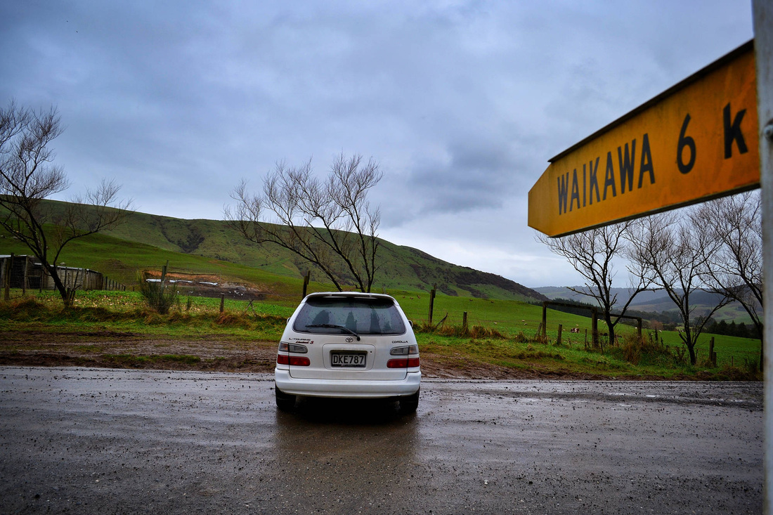
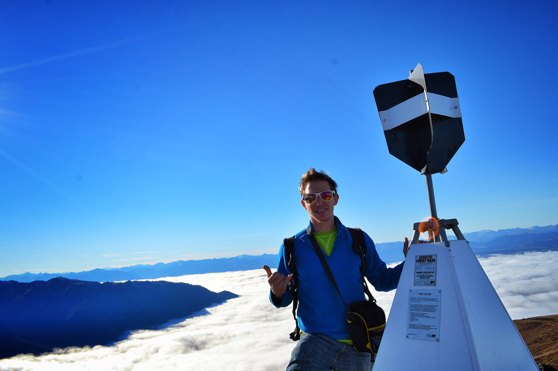
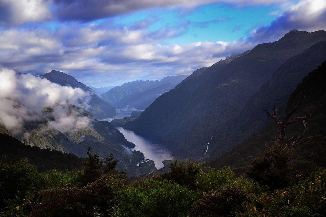
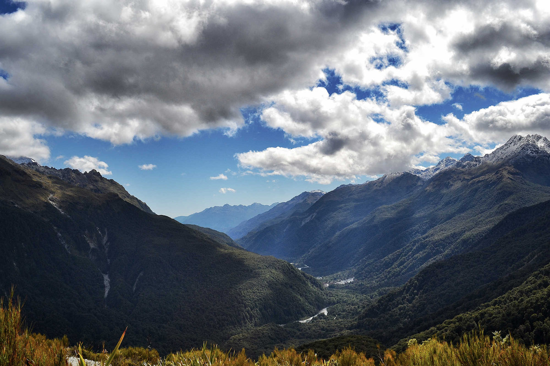
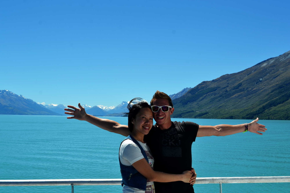
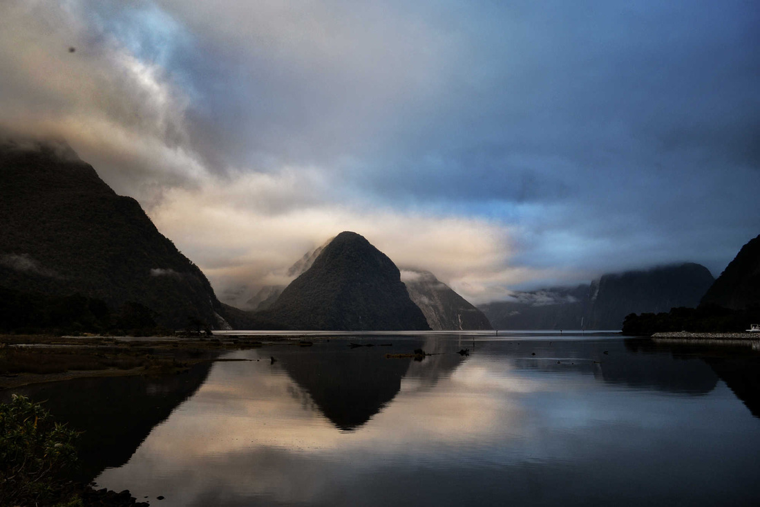
It has been now over a year that I ave been working in Milford Sound and this is truly an amazing place which is different every single day. I cannot stop taking pictures of this astonished area and will never be fed up of it. here below are few shots. Ca a fait plus d un an maintenant que je travaille a Milford Sound et c est un endroit vraiment impressionnant qui est different tous les jours. Je ne peux pas m arreter de prendre des photos de cette endroit etonnant et je ne m en lasserai jamais. Ci-dessous sont quelques cliches
0 Comments
Being the summer season in New Zealand meaning that the weather is suppose to be better we decided to hit the road and finish our trip around the Catlins and head to te Mcleans falls were we decided to camp, Mcleans Falls Holiday Park were you have a beautiful view and peace and quiet time in the middle of Catlins Forest Park. Mcleans Fall is on the Tautuku River and descends a number of steep drop offs and terraces. This is really nice to see and it only a 30min walk. In the same area just few kilometers away of the Mcleans falls you find Catedrale Caves which are one of the thirty longest sea caves in the world, located on Waipati Beach. They are a 'must see' - being one of the most popular tourist attractions in the area, along with the McLean Falls. The two main cave systems join together within the cliff and one has a 30 m (100 ft) high ceiling. The caves are only accessible 2 hours either side of low tide. Access to the caves from the road crosses private land, with a small user fee being charged to help maintain the road. On the way to Papatowai we have found this crazy cafe were the owner has a bus full of and-made gadgets made of recycled materials. This is amazing wat you can do with nothing! There is a theater that you can visit and being the best of his creations. Running out of time we could not do it but for sure worth it and is full of surprises! Having few days off Junia and myself decided to go through the Catlins in the southeastern corner of the South Island of New Zealand. From Milford Sound we decided to drive all the way to the East of the Catlins and start with Nugget Point, the opposite side of the south island, back to Ivercagill. A rugged, sparsely populated area, the Catlins features a scenic coastal landscape and dense temperate rainforest, both of which harbour many endangered species of birds, most notably the rare yellow-eyed penguin. The coast attracts numerous marine mammals, among them New Zealand fur seals and Hooker's sea lions. In general terms the area enjoys a maritime temperate climate. Its exposed location leads to its frequently wild weather and heavy ocean swells, which are an attraction to big-wave surfers, and have also caused numerous shipwrecks. Ayant quelques jours de repos Junia et moi-meme avons decide de traverser les Catlins dans le coin le plus au Sud-Est de l'Ile du Sud de la Nouvelle-Zelande . De Milforfd Sound nous decidons de conduire jusqu'a l'Est de Catlins et commencons avec Nugget Point vers lautre cote de l'Ile du Sud, Ivercagill. Un endroit rude et peu people, Les Catlins presente un paysage litoral et dense en foret tropicale, qui les deux refugent de nombreuses especes d’oiseau, qui la plupart sont de rare penguin a oeil jaune. La cote attire de nombreux mamiferes marins, tels que l’otarie a fourrure ou autrement appele l’ours de mer ou alors une autre espece d’otarie, le lion de mer de NZ. En terme general l’endroit apprecie un climat maritme tempere et est frequement expose a une meteo sauvage et severes houles de la mer, qui sont une attraction aux surfers et ont aussi cause de nombreux naufrages marins. Nugget Point To reach Nugget Point we then drove 355Km, from there the scenery completely change and is breathtaking. This is one of the most iconic landforms on the Otago coast. Located at the northern end of the Catlins coast down the road from Kaka Point, this steep headland has a lighthouse at its tip, surrounded by rocky islets (The Nuggets). The point is home to many seabirds, including penguins, gannets and spoonbills, and a large breeding colony of fur seals. Pour atteindre Nugget Point nous avons donc roule 355km et a partir de la le paysage changement dramatiquement a couper le soufle. Il s’agit d’une topographie la plus emblematique de la cote Otago. Situe sur la partie la plus au Nord de la cote Catlins, ce cap a un phare a son extrimite entoure d’ilots (the Nugget). Ce point est la maison de nombreux especes d’oiseaux maritimes, incluant Penguins, Morus, Spatules et une large colonie d’otarie a fourrure. Loving so much the wilderness of our first stop I decided to break the only car key into the car lock. This brought a bit of spiciness into our roadtrip!! Well the only option was to get a ride to the next village called Kaka Point and of course no mechanic as it was 4.00pm Saturday. We then spent a night here. Appreciant enormement cet endroit sauvage pour notre premier arret j’ai decide de casser la seule clef de la voiture dans la serrure, cela apporte un peu d’epices dans notre voyage !!!! Et bein la seule option est de retourner au prochain village appele Kaka Point avec un local et bein entendu aucun garage et nous sommes Samedi et il est 16h. Nous passons donc une nuit ici. Thanks to extremely generous and kind locals we got sorted the next day by having a mechanic coming early in the morning and putting everything apart so as to be able to start up the car without any key and then we took the way to the opposite side of the Catlins called Invercargill to get keyyyyyssss and hit the road again! Grace aux locaux extremement genereux et gentils, ils nous ont sorti d’affaire en ayant un garagiste venant tot le matin et demontant en bonne partie de la partie conducteur afin de demarer Snowy sans clef et ensuite prendre la direction d’Invercargill, une ville de l’autre cote de Catlins afin d’avoir de nouvelles clefs et repartir a nouveau !! On the way to the next destination Mataura River, I think there is no better scenery than this for you to fish and enjoy fresh air. Sur le chemin de la prochaine destination Mataura River, Je pense qu'il n'y a pas mieux que ce paysage pour pecher et apprecier l'air frais. Curio Bay After this twist of our original plan we decided to head to Curio Bay, 90km from Invercargill. Curio Bay is one of the major attractions in the Catlins, attracting around 100,000 visitors per year. Located near the southern end of New Zealand's South Island, Curio Bay is a coastal embayment best known as the site of a petrified forest some 180 million years old. It also hosts a yellow-eyed penguin colony, arguably the rarest of penguin species, with approximately 1600 breeding pairs in the extant population. The area along with Porpoise Bay is home to the endemic Hector's Dolphin, and Southern Right Whales that I did not get the chance to see unfortunately. Having nothing around you but only the open ocean, cliffs, breeze and wilderness make me think that we should simply enjoy the bare necessities of life! Apres un leger changement a notre plan original nous avons decide de se diriger vers Curio Bay, 90Km d'Invercargill. Curio Bay est une des majeures attractions des Catlins qui attirent environ 100 000 visiteurs par an. Situee pres du cap le plus haut Sud de l’Ile de la NZ, Curio Bay est la cote la plus reconnue en tant que site de foret petrifiee agee de 180 millions d’annee. Cette cote est egalement le site de colonie de Penguins a oeil jaune, le plus rare des especes penguins, avec approximativement 1600pairs d’ elevage dans la population encore existante. Cet endroit s’etend avec Porpoise Bay accueillant les Dolphins Hector (dauphin de Nouvelle-Zélande ou dauphin à front blanc) et Baleines Franches Autrales don’t je n’ai eu la chance de voir malheureusement ! N'ayant rien autour de soi mais seulement le vaste ocean, falaises, vent marin et la nature sauvage me fait penser que nous devrions simplement apprecier des simples necessites de la vie! Niagara Falls / Chutes du Niagara Hahaha this name is really hilarious when you know that Niagara Falls are based in Canada. Well the only way to make sure there is only one in the world is to go there and check with our own eyes! Sometimes it is better to believe only what you see yourself! Below are some pictures of it!!! Hahaha ce nom est vraiment marrant lorsque vous savez que les Chutes de Niaga sont situees au Canada. Et bien la seule maniere d’etre sure qu’il y en a qu’une au monde cest d’y aller et verifier de ses propres yeux! Des fois il est preferable de croire a ce que tu vois toi meme ! Ci-dessous sont les photos!!! These falls have been named by a surveyor who visited the real Niagara falls and wanted to give a bit of humour to this area! Ces chutes ont ete nommees par un geometre qui a visite les vraies Chutes du Niagara et voulait y donner un peu d'humour! I think there is a small problem with the direction of the sign, where do I go next? Je pense qu'il y a un petit probleme avec la direction des panneaux signaletiques, Ou vais-je ensuite? Well we found our way to a nice cafe called Niagara Falls Cafe Restaurant. A cup of coffee and piece of carrot cake were really enjoyable over there. We also got the chance to see the real Olympic medals as the owner's daughter won the track cycling London Paralympic Games 2012! Et bien nous avons trouve un jolie cafe appele Niagara Falls. Une tasse de cafe et une part de gateau aux carrotes est vraiment agreable. Nous avons egalement eu la chance de voir de vraies medailles olympiques car la fille de la proprietaire a gagne les jeux paralympiques de Londres, epreuve de clyclisme! Slope Point Slope Point is the southernmost point of the South Island of New Zealand. The land around Slope Point is used for sheep farming with no houses anywhere nearby. Eroded cliffs drop down to the sea below. An AA signpost there shows the distance to the Equator and the South Pole, and a small solar-powered lighthouse stands on farmland. Yet again the landscape is empty, immense and breathtaking. By sitting on the edge of the cliff you forget everything and only listen to the sound of the pure nature! There is no road to Slope Point; it must be reached by a 20-minute walk following dilapidated yellow markers. Slope Point est le point le plus au Sud de l’Ile de la Nouvelle-Zelande. Le terrain autour de Sople Point est utilise en tant qu’elevage de mouton avec aucune maisons dans les alentours. Encore une fois le paysage est vide, vaste et a couper le soufle. En vous assayant au bord de la falaise vous oubliez tout et ecoutez seulement les bruits de la nature pure! Un signe jaune y montre la distance de l’Equateur et Pole Sud, et une petit phare a panneau solaire se trouve sur la terre d’elevage. Il n’y a pas de route vous conduisant a Slope point mais une marche de 20min sur les terres en suivant des marqueurs jaunes vous y conduise. Because of the car incident we did not get enough time to travel more of The Catlins but this was not the end of our time in NZ and summer is coming soon so there will be more information and pictures about it coming soon :)
A cause de l'incident avec la voiture que nous avons eu, nous n'avons pas eu le temps de voyager plus a travers Les Catlins mais ce n'est pas la fin de notre temps en NZ et l'ete arrive bientot donc plus d'informations et photos seront postes bientot :) Catlins is the last part of NZ I have not been to yet and it is recommended to get a car to explore most of it as well as the rest of NZ. Therefore for this reason I introduce you Snowy our new adventurer friend which will drive us anywhere we want at anytime.
Fun rides and wild adventures are planned! Catlins est la derniere partie de la NZ que je ne suis pas allee et il est recommende d'avoir une voiture pour en visiter la plus part comme le reste de la NZ. Par consequent, je vous presente Snowy ou autrement dit Milou notre ami l'aventurier qui nous conduira partout a n'importe quel moment. De nombreux voyages et aventures sauvages sont prevus! Early April 2014 I published some pictures about Key Summit (http://jsinnz.weebly.com/menu/key-summit-milford-sound) being part of the New-Zealand Great Walks, this time some friends and I decided to do part of the Kepler Track and hicked to Luxmore Hut (1085m altitude) to chill out on the top of the clouds and spend a night! Indeed the night was a bit chilly though!! Next day we woke up and took thhe direction to Mont Luxmore the summit and highest part of the track 1472m altitude to then go back down! The Kepler is a 60Km circular tranping track starting from the Lake Te Anau Control Gates, Te Anau being a small town 2h away of Milford Sound. However from the Control Gates to Luxmore hut there is 13.8Km which can be done in 4-5h. The view is outstanding a 360 degree view including Lake Te Anau. There is also a cave called Luxmore cave which is great to visit and where we celebrated our friend's birthday, it could be creepy but at the end this was very lovely. Those 2 tramping days were beautiful and could not expect better than what we got, beautiful weather, wildness, coldness, friends, food and liquid! Cannot wait to do the full track soon..... Debut Avril 2014 j'ai publie quelques photos de Key Summit (http://jsinnz.weebly.com/menu/key-summit-milford-sound) faisant parti des Grandes marches de Nouvelle Zelande, cette fois quelques amis et moi-meme avons decide de faire la randonnee Kepler et avons marche jusaue la Hute Luxmore (1085m d'altitude) afin de relaxer au dessus des nuages et passer une nuit! Cette nuit fut assez rafraichissante en effet!!! Le jour suivant nous nous sommes reveilles et avons pris la direction du Mont Luxmore, le sommet et la plus haute partie de la randonnee 1472m d'altitude pour ensuite redescendre! Kepler est une rando de 60Kmcirculaire commencant du lac TRe Anau a la porte Control Gates, Te Anau etant une petite ville a 2h de Milford Sound. Cependant de la porte Control Gates a la Hute Luxmore il y a 13,8Km qui peut etre fait en 4 a 5h. La vue est epoustouflante, une vue 360 degree incluant le lac Te Anau. Il y a egalement une cave appelee Cave Luxmore interessante a visiter et ou nous avons celebre l'anniversaire d'un ami! Cela peut etre un peu effrayant mais a la fin c'etait super sympa. Ces 2 jours de rando etaient superbes et nous ne pouvions pas esperer mieux, beau temps, nature, froid, amis, nourriture et liquide! Je ne peux pas attendre de faire la rando complete.... Comme vous avez pu lire precedemment sur mon blog, je travail et vis actuellement a Milford Sound qui fait parti du parc national Fiordland representant 12,120 KM2 et faisant egalement parti des 14 Fjord de ce pac national. Et bien j’ai eu l’ooportunite de voyager un jour sur un autre Fjord appele Doubtful Sound qui est deux foix plus grand que Milford Sound, environ 40,4Km et 421 metres de profondeur le faisant le plus profond des Fjords. Pour y acceder, cela prend 1 jour car vous devez dans un premier temps prendre un premier bateauet naviguer le Lac Manapouri qui est le second lac le plus profond de Nouvelle Zelande, contient 33 iles au total et a ete forme par glacier, vous prenez un premiere claque dans la tete !! Ensuite vous en prenez une deuxieme en voyage sur terre ferme en bus qui vous envois un apercu de Doubtful Sound et seulement apres vous naviguez sur le Fjord pendant 3h qui vous assome pour de bon ! Doubtful Sound etait nomme Doubtful Harbour' en 1770 par Captain Cook,. Il n’y s’est pas aventure car il etait incertain que cela soit navigable en voilier. Le Fjord etait renomme par la suite Doubtful Sound les chasseurs de baleine et de phoque,. Compare a Milford Sound, il n’y a personne y vivant ou habitant avec exception les dauphins, penguins, phoques et autres especes sauvages.... mais attendez une minute !!! C’est ce que je suis en train de devenir, couvert de mousse et fougers en restant ici !! As you might have read previously on my blog, I am currently staying and working in Milford Sound part of the Fiordland National park an area of 12,120 square kilometres and also part of the 14 Fjord in this National park. Well I got the opportunity to travel 1 day through another one called Doubtful Sound which is twice longer than Milford Sound, around 40.4 kilometres and 421 metres deep making it the deepest of the fiords. To go there it takes a full day as you have to get a first boat and cruise onto Manapouri lake New Zealand’ssecond deepest lake measuring 444 metres, contains 33 islands in total and was formed by glacier, you get a first slap into your face with scenery. Then you get a second slap by getting a ride by bus and having a first view of the Fjord and only then you cruise onto the doubtful for 3h and you get knocked out!! Doubtful Sound was named 'Doubtful Harbour' in 1770 by Captain Cook, who did not enter the inlet as he was uncertain whether it was navigable under sail. It was later renamed Doubtful Sound by whalers and sealers, although it is not technically a sound but a fiord. Compared to Milford Sound there is no one living there except dolphins, penguins, seals and all other wild life…. but wait a sec!!! This is what I am becoming, full of moss and ferns by staying here!!! Milford Sound is surrounded by mountains and therefore many treks are available so as to visit this wonderful National Park. Around the area, 3 of them are are well-known as Great Walks and are Kepler track, Milford track and Routeburn Track and all of them are 3 to 4 days walk. Well by a sudden beautiful weather we decided to get our butt out of the bed, hitchhike to Routeburn starting point and do one part of it called Key Summit (918m). This is a one 2-3 hours return tramp which gives you amazing views over the Humboldt, Darran Mountains and lake Marian!!! Enjoy the pictures!! Milford Sound est entoure par les montagnes et par consequent de nombreuses randonnees sont disponibles afin de visiter ce superbe parc national. Autour de cet endroit, 3 randonnees sont reputes en tant que Grandes Marches, il s'agit des randonnees Kepler, Milford et Routeburn. Toutes les 3 sont des marches de 3 a 4 jours1 Et bien par un temps magnifique nous decidons to sortir nos fesses du lit, faisons de l'autostop au point de depart de Routeburn et marchons une partie appele Key Summit (918m). Il s'agit d'une marche de 2 a 3h aller-retour donnant de superbes vues sur Humboldt, les montagnes Darran et le lac Marian. Bon Voyage! When you are in Queenstown one of the first thing that you might spot is Wakatipu lake which is a length of 80 kilometres (50 mi), it is New Zealand's longest lake, and, at 291 km2, its third largest. Many activities are operated on it like Speed Boat, old steam boat as new catamaran boat...etc. Junia and myself therefore decided to explore it with the Xtrem way, Speed Boat, as Queenstown is THE city for Xtrem Sport but also with the quiet version by crusing with a catamaran and having a 4WD ride around Mount Nicholas while discovering a sheep farm station. Well yet again the scenery is magnificient and breathtaking even better when you have the privilege to be a private group! Lorsque vous etes a Queenstown, la premiere chose que vous pouvez voir est le Lac Wakatipu qui est a une longueur de 80Km, il s'agit du lac le plus long de Nouvelle-Zelande et a 291 km2 qui en fait le troisieme plus large! De nombreuses activite y sont operes comme Speed Boat, vieux bateau a vapeur et nouveau bateau comme catamaran...Ect Junia et moi-meme avons choisi la version extreme Speed Boat car Queenstown est aussi la ville du sport Extreme et sensation mais aussi la version plus calme Catamaran a moteur pour ensuite rejoindre le Mont Nicholas en le traverssant en 4x4 tout en decouvrant une ferme de mouton. Et Bien encore une fois le paysage is magnifique et stupefiant voire encore plus quand vous avez le privilege d'etre un group prive! View around the lake / Vue autour du lac Visit of a sheep (Merino) farm / visite d'une ferme de mouton (Merino) On a dirt road with a 4WD, let's be crazy!!!!! / Sur la route avec un 4 roues motrices, soyons fou!!!
It has been a while I have not posted anything on my blog as indeed since I have left Asia and my best mate. I am now back in New Zealand with my girlfriend and in one of the most remote but beautiful National Park called Fiordland National Park (12,500km²). Some pictures of Milford Sound / Quelques photos de Milford Sound More pictures of species around Milford Sound / Plus de photos des animaux autour a Milford Sound
|
Archives
February 2015
Categories
All
|